• Region

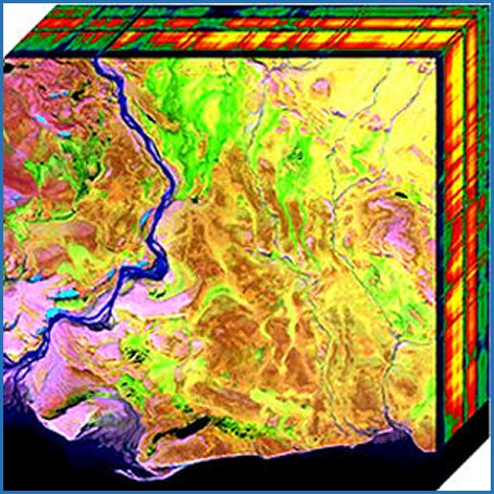
TimeScan Raw Data (FORT MCMURRAY)

German Aerospace Centre (DLR), Data extracted from the TimeScan Geoservice by Hyperspectral Intelligence in partnership with Maapera Analytics Inc.

  • Data Provider
    Alberta Agriculture and Forestry
  • Currency
    Grassland Vegetation Classification Using TimeScan Data extracted and classified from the Landsat satellite archive maintained by the DLR in discrete 3 year time slices as follows: 1984 – 1986; 1987 – 1989; 1990 – 1992; 1993 – 1995; 1996 – 1998; 1999 – 2001; 2002 – 2004; 2008 – 2010; 2011 – 2013; 2014 – 2016.
  • Format
    GeoTIFF
  • Projection
    NAD_1983_10TM_AEP_Forest
Product Image

Derived Ecosite Phase Mapping (Fort McMurray)

A fine-scale spatial inventory unit defined by the recurring patterns of one or more vegetation and soil types within a specific landscape context. It is the primary scale for corporate-level inventory and the development of interpretation for natural resource planning...

  • Data Provider
    Government of Alberta
  • Currency
    2016-05-18
  • Format
    SHP
  • Projection
    NAD 1983 10TM AEP Forest
Product Image

Wildlife Sensitivity (Fort McMurray)

These wildlife feature layers provide industrial operators, government departments and the general public with the best information currently available on the extent of wildlife sensitivities.

  • Data Provider
    Alberta Environment and Parks
  • Currency
    2016-04-28
  • Format
    SHP
  • Projection
    NAD 1983 10TM AEP Forest
Product Image

Natural Regions and Subregions of Alberta (Fort McMurray)

This dataset defines the ecological areas of Alberta known as the Natural Regions and Natural Subregions, as defined in 2004/2005. The intended scale of use of this product is 1:250 000. This version is 2005 Final. Note that the Athabasca...

  • Data Provider
    Alberta Environment and Parks
  • Currency
    2005-06-02
  • Format
    SHP
  • Projection
    NAD 1983 10TM AEP Forest
Product Image

DIDs+ (Fort McMurray)

Authority to use public land is granted through dispositions issued under the provisions of the Public Lands Act. A disposition is a land use contract that gives specific rights to a land or resource user (lease, license, or permit). Examples...

  • Data Provider
    Altalis Ltd.
  • Currency
    2016-09-09
  • Format
    SHP
  • Projection
    Geographic Coordinates
Product Image

Title Mapping (Fort McMurray)

Parcel ownership polygons & associated Microsoft Access database files showing Parcel Identifiers (PIDs) and Land Identification Numeric Code (LINC) numbers as recorded in the Certificates of Title registered at Alberta Land Titles Office. It includes data for freehold, crown, and...

  • Data Provider
    Altalis Ltd.
  • Currency
    2016-09-09
  • Format
    SHP
  • Projection
    Geographic Coordinates
Product Image

Municipal Boundary File (Fort McMurray)

Alberta Municipal boundary polygons that include Counties, MD’s, Special Areas, Improvement Districts, Cities, Towns, Villages, Summer Villages, Hamlets (most Hamlets are depicted using points and only a few have boundaries) and most First Nation Reserves. This dataset is kept current...

  • Data Provider
    Altalis Ltd.
  • Currency
    2016-09-01
  • Format
    SHP
  • Projection
    Geographic Coordinates
Product Image

ATS V4.1 Polygons (Fort McMurray)

The ATS V4.1 Polygons dataset includes Legal Sub Divisions (LSD), quarter section, section, each with statutory road allowances & township polygons, derived from the master Alberta Township System (ATS) V4.1 coordinates that were ‘frozen’ by the Government of Alberta in...

  • Data Provider
    Altalis Ltd.
  • Currency
    2009-08-05
  • Format
    SHP
  • Projection
    Geographic Coordinates
Product Image

20K Base Features (Fort McMurray)

The 1:20 000 Base Features is a GIS spatial database that includes over 60 layers of topographic information separated into 5 major themes:Access - The location and nature of features that can be used to gain vehicular access to land...

  • Data Provider
    Altalis Ltd.
  • Currency
    2016-01-18
  • Format
    SHP
  • Projection
    Geographic Coordinates
Product Image

250K Small Scale (Fort McMurray)

250K Small Scale is a vector representation of the major topographic features of Alberta, commonly used for wall maps as they cover a large area. The four themes include:Alberta Township System Linework - section level for surveyed territory and township...

  • Data Provider
    Altalis Ltd.
  • Currency
    2016-03-01
  • Format
    DWG
  • Projection
    UTM
Product Image

20K DEM (Fort McMurray)

A Digital Elevation Model (DEM) is a digital representation of ground surface topology or relief. The 20K DEM contains three dimensional spatial ground elevation masspoints, which are spot elevation points, hard breaklines, which include cliffs, ridges, peaks, and bodies of...

  • Data Provider
    Altalis Ltd.
  • Currency
    2002-06-04
  • Format
    ASCII
  • Projection
    10TM
Product Image

LiDAR15 DEM (Fort McMurray)

LiDAR15 DEM is a high accuracy and high resolution DEM that has been collected by LiDAR technology and processed into 15 meter post spacing, Bare Earth XYZ ASCII coordinates. DEM collected with LiDAR (Light Detection and Ranging) technology enhances the...

  • Data Provider
    Altalis Ltd.
  • Currency
    2011
  • Format
    ASCII
  • Projection
    UTM
Product Image

Lidar (Fort McMurray)

Lidar point cloud and derivative products: Classified point cloud, 1m DEM & DSM, Hill shade images.

  • Data Provider
    Airborne Imaging, a Clean Harbors company
  • Currency
    2011
  • Format
    Multiple
  • Projection
    UTM (Zone 12), nad83csrs, cgvd28 / Horizontal: EPSG 2955 & 2956, Vertical: 5713
Product Image

LiDAR: OIL SANDS (FORT MCMURRAY)

The Oil Sands Data project included the collection of hyperspectral, lidar and digital image data in five project sites at and near Fort McMurray using a fixed wing aircraft with lidar system and hyperspectral sensor. A combined GPS/INS System (Inertial...

  • Data Provider
    NRCAN & University of Victoria
  • Currency
    August 2013
  • Format
    LAS
  • Projection
    UTM (Zone12)
Product Image

ORTHOPHOTOS: OIL SANDS (FORT MCMURRAY)

The Oil Sands Data project included the collection of hyperspectral, lidar and digital image data in five project sites at and near Fort McMurray using a fixed wing aircraft with lidar system and hyperspectral sensor. A combined GPS/INS System (Inertial...

  • Data Provider
    NRCAN & University of Victoria
  • Currency
    August 2013
  • Format
    GeoTiff
  • Projection
    UTM (Zone 12)
Product Image

HYPERSPECTRAL IMAGERY: OIL SANDS (FORT MCMURRAY)

The Oil Sands Data project included the collection of hyperspectral, lidar and digital image data in five project sites at and near Fort McMurray using a fixed wing aircraft with lidar system and hyperspectral sensor. A combined GPS/INS System (Inertial...

  • Data Provider
    NRCAN & University of Victoria
  • Currency
    August 2013
  • Format
    ENVI (HDR, DAT)
  • Projection
    UTM (Zone 12)
Product Image

ORTHOPHOTO IMAGE (FORT MCMURRAY)

When an aerial photograph is geometrically corrected for distortions caused by topographic relief, lens distortion and camera tilt, it becomes ortho rectified.Orthophotos have a uniform scale, providing an accurate representation of the earth’s surface, and can be used to measure...

  • Data Provider
    Tarin Resource Services Ltd.
  • Currency
    2009-09-13
  • Format
    GeoTiff
  • Projection
    UTM (Zone 12)
Product Image

Satellite Imagery (Fort McMurray)

High-resolution satellite imagery: Multispectral (MS); Panchromatic (PAN) Satellite: Worldview 02 Spectral Bands: Panchromatic; 4-Band BGRN

  • Data Provider
    DigitalGlobe
  • Currency
    MS: Jul 1, 2010; Sept 19, 2010; May 24, 2011; Sept 26, 2011 PAN: Jul 1, 2010; Sept 19, 2010; May 24, 2011; Sept 26, 2011
  • Format
    GeoTiff
  • Projection
    UTM (Zone 12)
Product Image

Cadastral (Fort McMurray)

Cadastral data defines the location of survey plans registered with Alberta Land Titles. This mapping portrays block lines, lot lines, lot numbers, road limits, right of way limits, metes and bounds, plan numbers, dimensions and other information found on plans...

  • Data Provider
    Altalis Ltd.
  • Currency
    2016-09-09
  • Format
    DWG
  • Projection
    10TM
Product Image